UPDATE:
The heat does not help, but the lack of rain does.
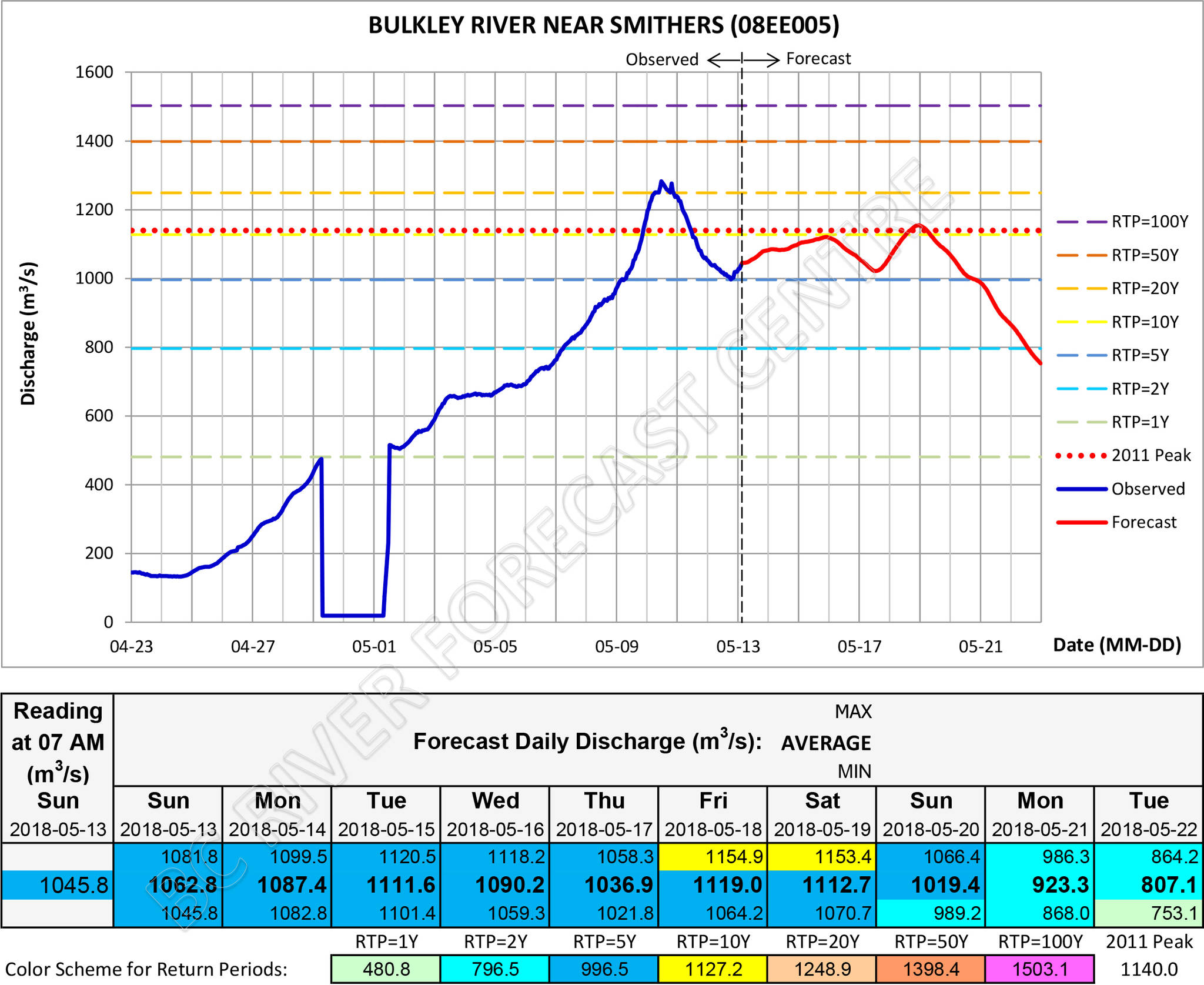
Bulkley River levels are still at 20-year event levels, but the once-per-century level forecast has come down — at least for Smithers. Things in Quick are still precarious with one model giving a worst-case scenario of a century-level event, but other models show things staying at about their current level into next weekend.
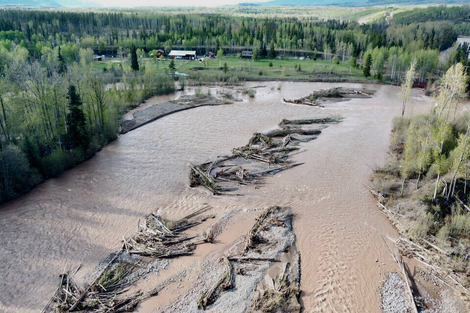
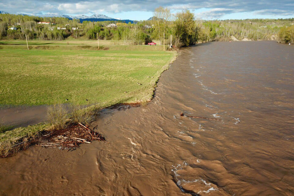
The rivers and tributaries should all be avoided with erosion making banks unstable.
ORIGINAL STORY:
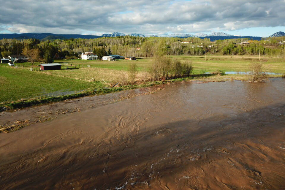
With very warm weather on the way, flooding is forecast to get worse — a lot worse.
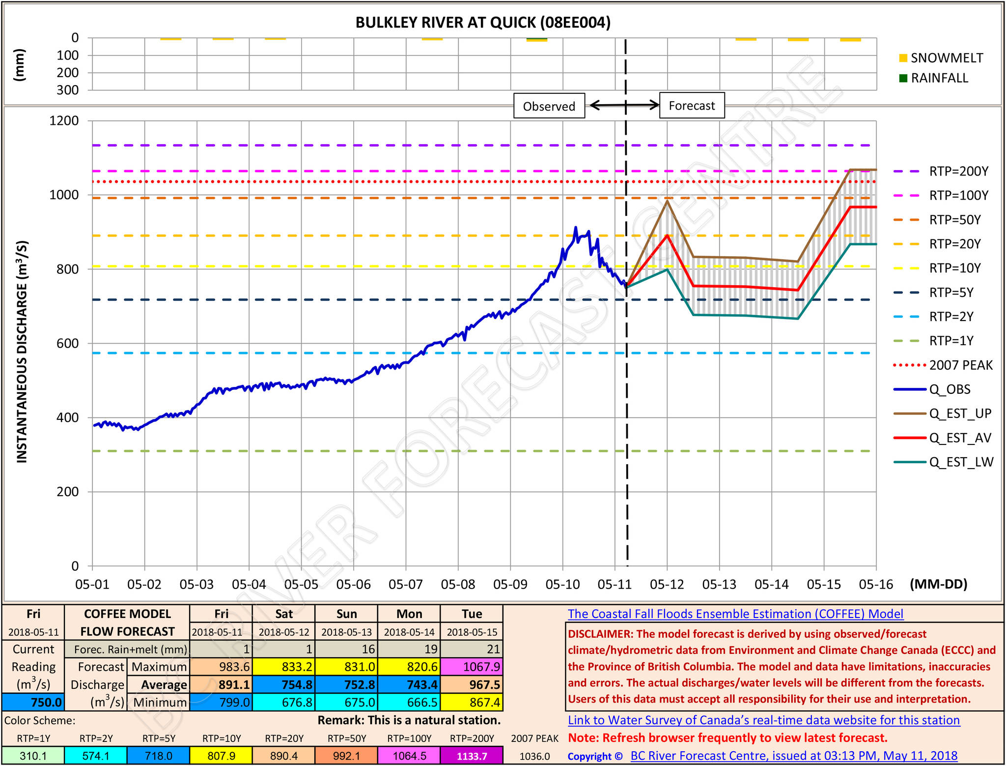
Data from the B.C. River Forecast Centre suggest the Bulkley River may rise to one-in-100 year levels by mid next week. The current forecast suggests the river will dip before rising to record-setting levels.
The critical days were described as Monday to Wednesday by David Campbell, head of the British Columbia River Forecast Centre.
The forecast highs in the low to mid-20s are causing very high levels of snowpack to melt and run into tributaries feeding the river.
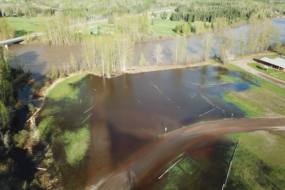
The highest levels are expected in Smithers and Quick. Houston is expected to peak at 20-year levels.
The Regional District of Bulkley-Nechako has the Ebenezer area under evacuation alert. Residents are asked to be prepared on very short notice.
Kidd Rd, Columbia, 22nd Ave (Ebeneezer flats) area residents monitoring BulkleyRiver levels #SmithersBC. Stay safe and be prepared. pic.twitter.com/dxFyQEBWk3
— BV Lakes StikineDist (@TranBC_BVLDS) May 10, 2018
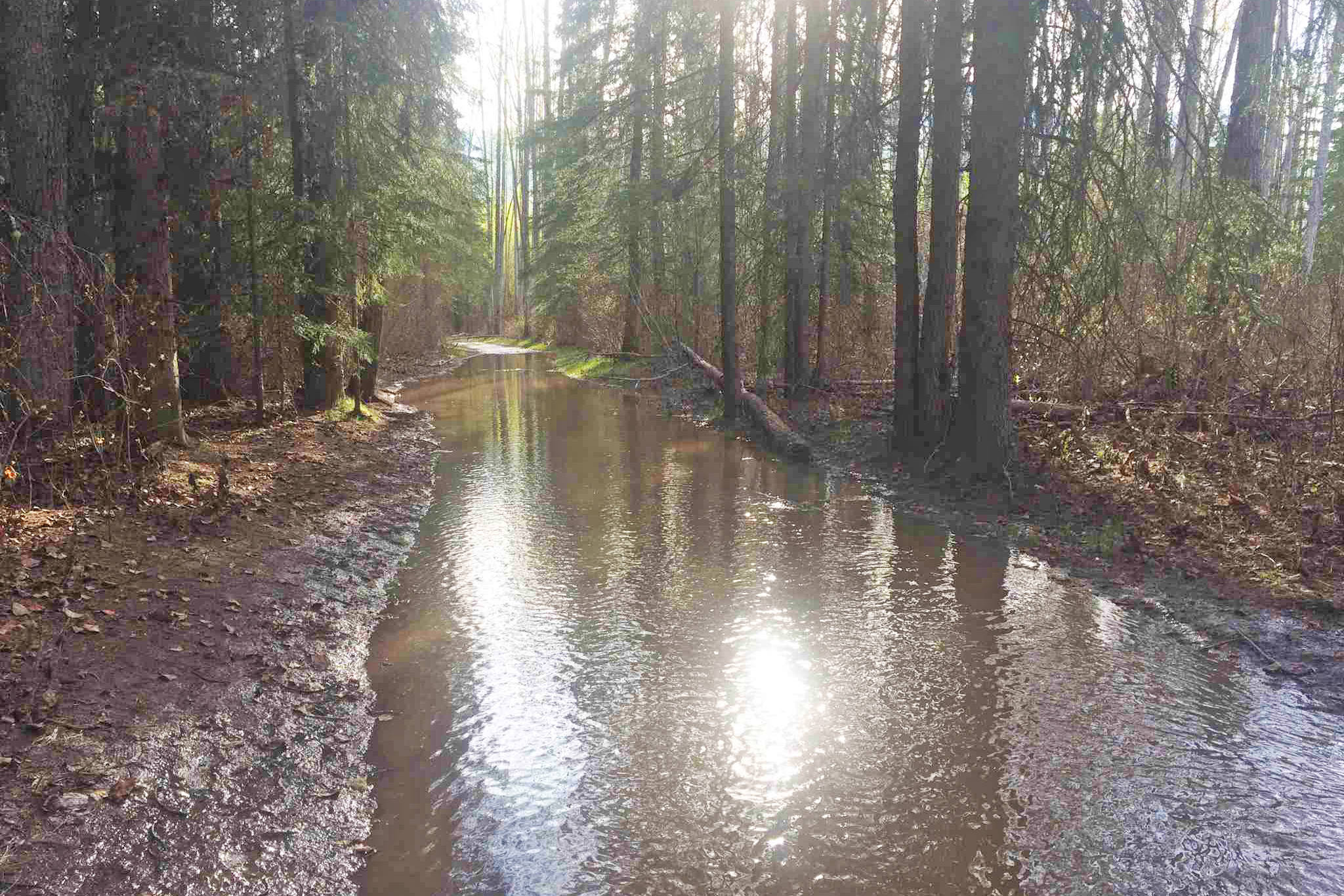
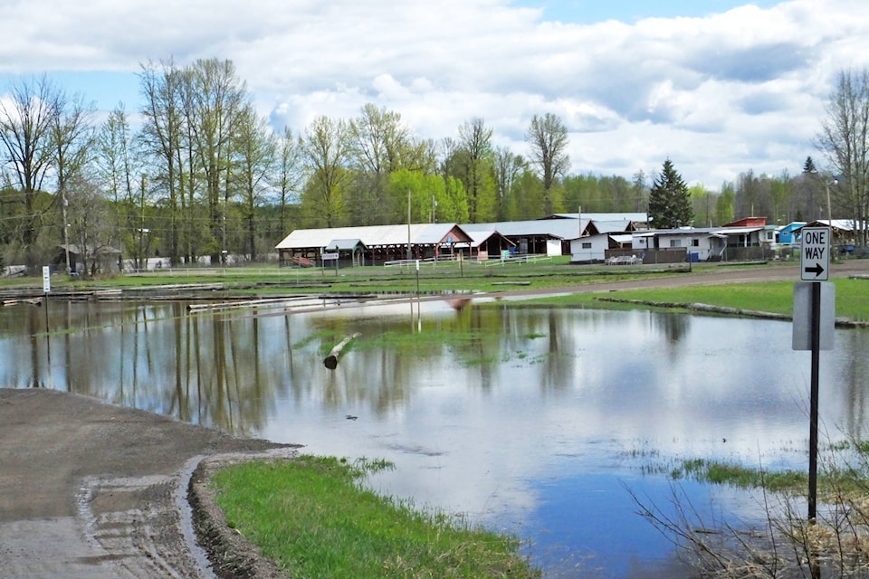
The Town of Smithers has closed the Perimeter Trail by Riverside Campground, the Fall Fairgrounds, the 2100 block of Riverside Drive, and the 2100 block of Main Street.
More information is available at gov.bc.ca/riverforecast.
Campbell explained Friday how the Bulkley Valley and other areas are at the mercy of the weather went it comes to melting those deep snowpacks.
“Obviously, prolonged hot followed by an intense wet period would be of extreme concern. But the hot weather we’ve got is particularly concerning for the flood outlook for the next seven days,” he said.
Chris Duffy, executive director of programs with Emergency Management BC, said four of six regional emergency operation centres have been activated across the province. The closest to the Bulkley Valley open is the North East centre in Prince George. The North West centre in Terrace has not been activated as of Friday.
The cool weather Wednesday and Thursday helped keep the Bulkley River from rising too quickly, but things are definitely not expected to stay that way.
“I think that’s going to be somewhat short-lived. We do now have the potential with this warming trend that we’ll see that start to reverse and start to climb again,” said Campbell.
“Expect that the situation will get worse there before we get better.”
He added that the higher elevations still have plenty of snow. Houston is better off and should not raise the rivers much more, but the Telkwa system and areas northeast of Smithers were described as still quite highly covered in snow.
“I still think there is enough snow to be fueling some response with the temperatures that we’re expecting,” said Campbell.
Duffy said BC Highways has plans for any emergency infrastructure or detours if anything were to happen to the vital Highway 16 artery that keeps the Northwest connected.